After the flood – October, 2019
Oxbow Farm & Conservation Center is adjacent to the Snoqualmie River, a vital waterway that flows from the Cascade Mountains down to the Snoqualmie Valley, eventually meeting up with the Snohomish River, and then emptying into the Puget Sound. Being located in the low-lying river valley, Oxbow is subject to regular seasonal flooding from approximately November through April every year. Earlier last week the Snoqualmie Valley experienced one of the earliest major floods on record, causing huge losses for many local farms.
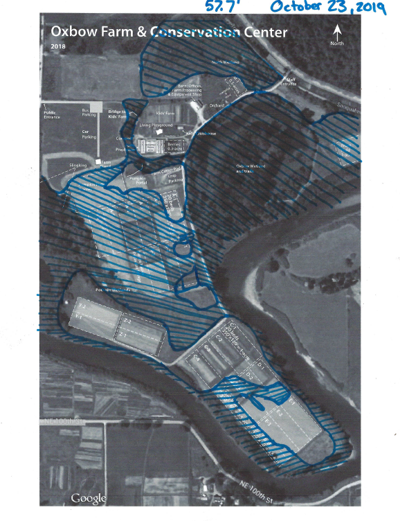
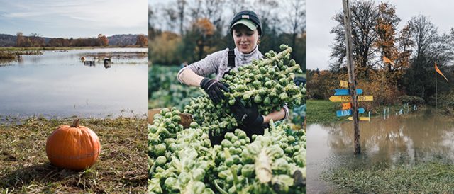
Oxbow took a hit, but thanks to extensive prep completed by our staff we were to able harvest and store many crops that would have otherwise been lost to the flood. Crops typically aren’t “lost” by being washed away; they’re lost because food that comes into contact with floodwaters cannot, by federal USDA law, be sold for human consumption. For many farms, flooding can mean that growing seasons are cut short by several months and best laid plans float, quite literally, downstream. For Oxbow, it means that we’ve had to cancel our plans for a Winter CSA Program.
Why farm in a floodplain?
With the risk of such huge losses, why do farmers even bother? The biggest trade-off is the nutrient-rich soil that floods leave behind, making excellent growing conditions for organic veggies. Next time you crunch into one of Oxbow’s finest carrots, say a little word of thanks to the mighty Snoqualmie! Another possible benefit of flooding is that it may wash away the nests of nuisance insects for the growing season to follow, but the jury is out on whether or not reports of reduced pests are anything more than anecdotal.
During particularly tough seasons, farmers might wonder if it’s worth it; but the farmers at Oxbow (and many of our neighbors) have been farming in a floodplain for decades. Going back even further to times prior to European settlement in the 19th century, the people of the Snoqualmie Indian Tribe (sdukʷalbixʷ) grew on and cared for the floodplains of the valley and far beyond.
The river gives our region so much, and we try to return the favor by restoring riparian buffers, improving habitat for wildlife, and practicing regenerative agriculture that improves local land and waterways.
Is it worth it? We think so.
A few flood FAQs
Why does flooding occur in the Snoqualmie River Valley?
The Snoqualmie River has a drainage of 693 square miles, and when there are strong rainfall or snowmelt events (or a combination, when there’s a “rain-on-snow” event) at higher elevations, all the runoff must exit down the channel of the Snoqualmie River. When the volume is too much for the channel, it spills out onto the larger floodplain. For Oxbow and other farms in the valley, that means we see floods an average of 2-3 times each winter
Click here to see a map of the Snoqualmie-Skykomish Watershed.
Is food grown in a floodplain safe?
Yes. All food for sale in Oxbow’s Farm Stand is WSDA Certified Organic and was not impacted by flooding. We are prohibited by law from selling food that has come into contact with floodwater.
Why is food that came in contact with floodwater inedible?
As water moves downstream and overflows riverbanks, it moves chemical and microbial runoff from neighboring lands with it – meaning there is a risk that contaminants can reach food that’s in the path of the flood. After a period of rest, fields can be planted again safely.
What happens to the food that you can’t sell due to flooding?
It will be worked back into the soil, providing nutrients to future successions of crops.
Do I need to take any extra precautions with the food I’ve purchased from Oxbow?
Since none of the food we sell has come into contact with floodwater, enjoy and prepare your food like you usually would!
If you have any questions for us, please reach out at thedirt@oxbow.org!